SoilTemp maps
One of the main goals of the SoilTemp network is to create high-resolution gridded microclimate products for use in ecology. Our first such products can be found here below. For the latest overview figure of database itself, see ‘The database’.
Currently, we have the following datasets available:
– Global maps of soil temperature
– Maps of European forest understory temperature
– Maps of pan-tropical forest understory temperature
See below for more details!
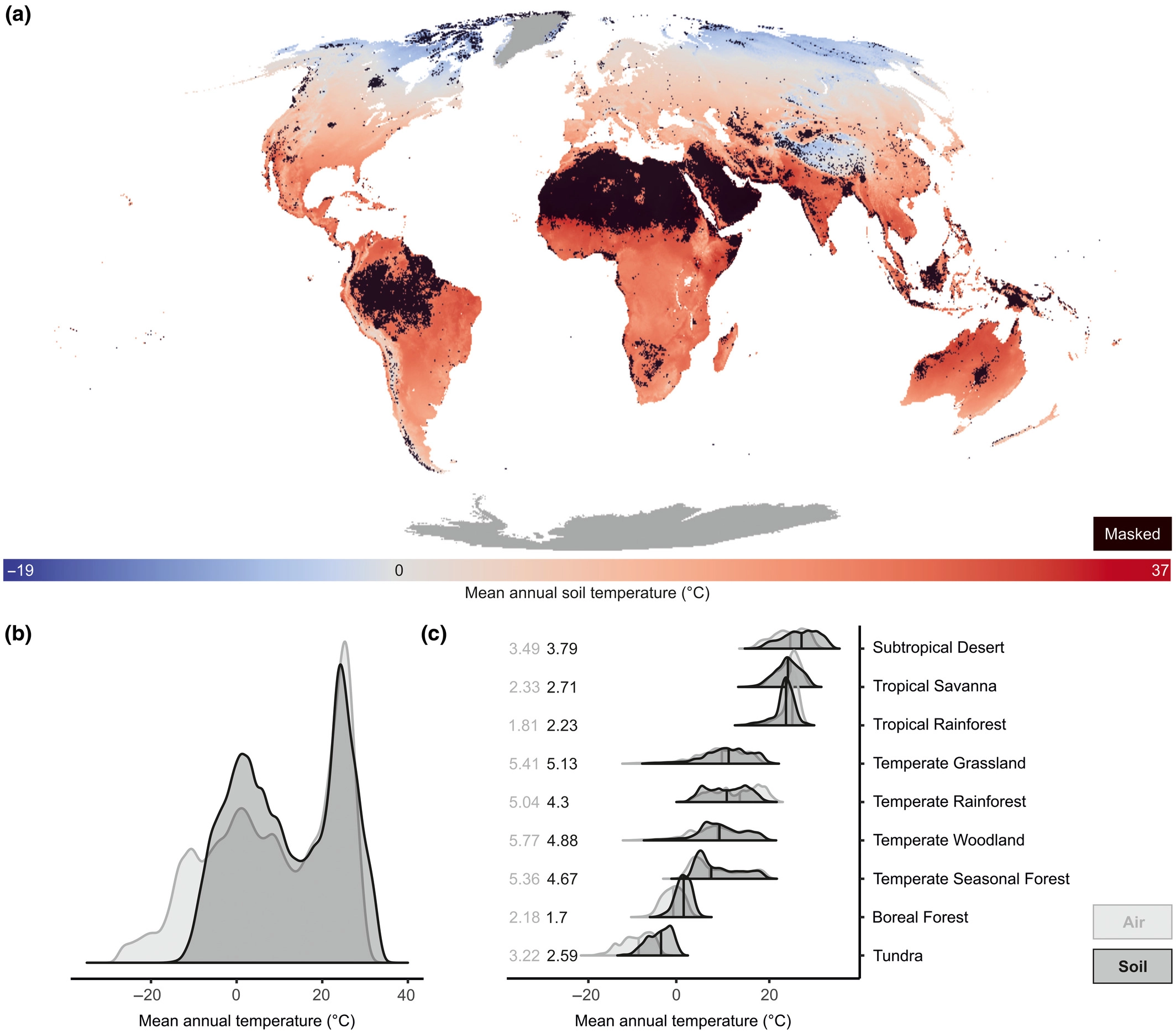
SoilTemp maps: Global maps of soil temperature
Resolution: ~1 km²
Height: 0-5 or 5-15 cm belowground
Type: bioclimatic variables
Paper: Lembrechts, J., Van den Hoogen, J., et al. (2022). Global maps of soil temperature. Global Change Biology. https://doi.org/10.1111/gcb.16060
Maps (GeoTIFFs): https://zenodo.org/record/7134169
These layers are also publicly available as Google Earth Engine assets. These are accessible via:
- https://code.earthengine.google.com/?asset=projects/crowtherlab/soil_bioclim/SBIO_v2_0_5cm
- https://code.earthengine.google.com/?asset=projects/crowtherlab/soil_bioclim/SBIO_v2_5_15cm
Source code and data: https://doi.org/10.5281/zenodo.4558663
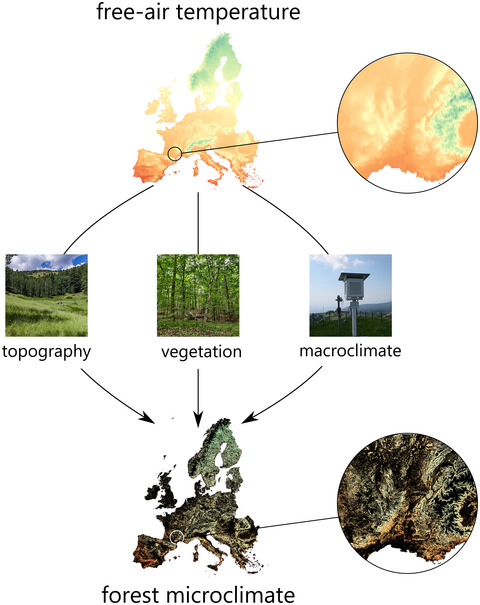
ForestTemp: sub-canopy temperatures of European forests
Resolution: ~25 m²
Height: 0-100 cm aboveground
Type: bioclimatic variables
Papers:
– Haesen, S., Lembrechts, J. J., De Frenne, P., Lenoir, J., Aalto, J., Ashcroft, M. B., … & Van Meerbeek, K. (2021). ForestTemp–Sub‐canopy microclimate temperatures of European forests. Global Change Biology, 27(23), 6307-6319. https://doi.org/10.1111/gcb.15892
– Haesen, S., Lembrechts, J. J., De Frenne, P., Lenoir, J., Aalto, J., Ashcroft, M. B., … & Van Meerbeek, K. (2023). ForestClim—Bioclimatic variables for microclimate temperatures of European forests. Global Change Biology. https://doi.org/10.1111/gcb.16678
Maps (GeoTIFFs): https://doi.org/10.6084/m9.figshare.14618235
Tropical forest understory temperature
Resolution: ~30 m²
Height: 15 cm aboveground
Type: bioclimatic variables
Paper: Ismaeel et al. (2024). Patterns of tropical forest understory temperatures. Nature Communications. 15, 549. https://doi.org/10.1038/s41467-024-44734-0
Maps (GeoTIFFs): https://doi.org/10.23729/dd3de08e-39a1-46b0-b28a-7bc577b6c914 (300 m resolution – 30 m available upon request)


